UAV with Lidar sensors to improve nuclear decommissioning
Pilots from Sellafield Ltd’s Engineering Centre of Excellence will fly the first unmanned aerial vehicle (UAV) fitted with Lidar sensors at a UK nuclear site.
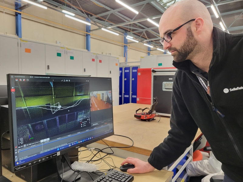
Sam Jay, UAV Engineer and Chief Pilot at Sellafield Engineering Centre of Excellence, looking at the screen display of the mapping images captured by the Flyability Elios 3 drone.
© Amanda SmithThe team based at Cleator Moor in Cumbria will fly the Swiss-made Flyability Elios 3 as part of a decommissioning programme at the site.
The UAV carries the latest Lidar technology, creating 3D visualisation, which gives the pilot full situational awareness while flying the drone.
The images are also stored for 3D mapping reference, data that can be output for design work and for decommissioning, providing vital information on the physical characterisation of cells.
The quadcopter, which uses ducted propellers, can be used to fly in hazardous environments such as active cells, taking away the need to involve humans in those areas.
The drone can operate in complete darkness with specialist thermal cameras and oblique lighting, inside full concrete cells and at up to 500m from an operator.
Peter King, Technical Specialist at the Centre of Excellence, says, 'The technology we are using will enable us to understand decommissioning requirements for inaccessible areas.'
The technology has already been used in the US, but this month will be the first time it has been used at a nuclear site in the UK.