Geological data visualised in Minecraft worlds
Free-to-download models explore the UK’s complex stratigraphy.
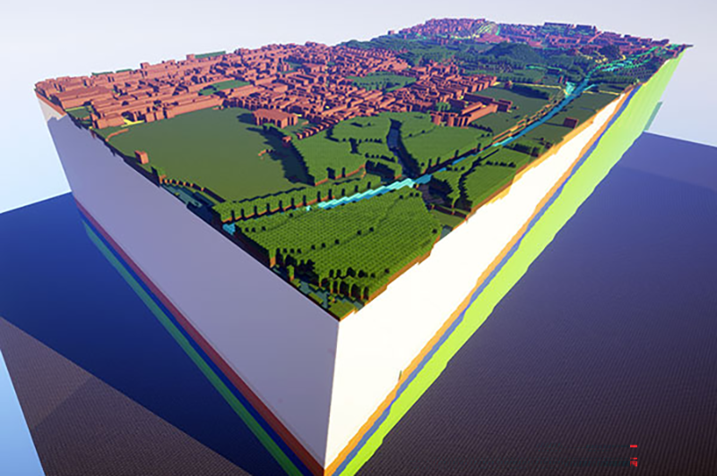
West Thurrock, UK, is one of the ‘worlds’ modelled
© British Geological Survey/UKRIThe British Geological Survey (BGS) has released five interactive Minecraft worlds, allowing players to explore layered subsurface geology alongside surface topography.
It hopes the platforms can communicate complex geological concepts to younger audiences while maintaining scientific integrity.
Each world uses coloured glass blocks that are assigned according to standard geological map conventions. They represent stratigraphic units.
This design choice enables players to dig through translucent layers and visualise complex subsurface architecture, from superficial deposits to deep bedrock formations.
Four of the worlds focus on specific UK regions: Glasgow (showing carboniferous coal measures and glacial tills); Ingleborough (featuring karst limestone landscapes); York (Triassic sandstone and Vale of York glacial deposits); and West Thurrock (chalk and younger sedimentary sequences). A fifth world represents the geology of mainland Great Britain at national scale.
Each model incorporates real BGS 3D geological data, digital elevation models and Ordnance Survey mapping. The Glasgow model extends to 100km² and shows both superficial deposits and bedrock geology, providing insight into construction-relevant geology and geothermal potential from flooded mine workings.
The worlds are free to download from the BGS website, the only requirement being a licensed copy of Minecraft and reasonable computer memory and storage.